-
The BlogBiographies
-
Videos

April 19, 1775
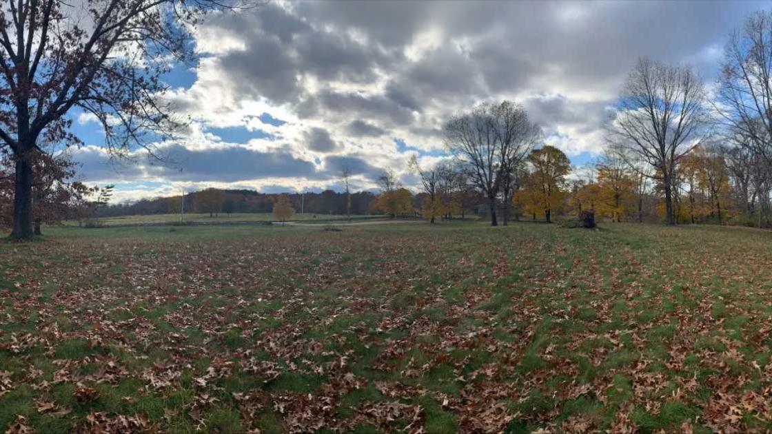
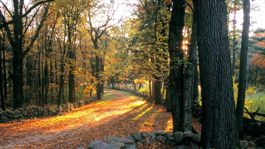
Follow the path of the British and Colonial forces along the storied Battle Road. This tour retraces the events of April 19, 1775, from the initial conflict at Lexington through Concord and along the route of the British retreat. Walk in the footsteps of militiamen and redcoats as you explore key battle sites, colonial homes, and landscapes that witnessed the opening shots of the American Revolution.
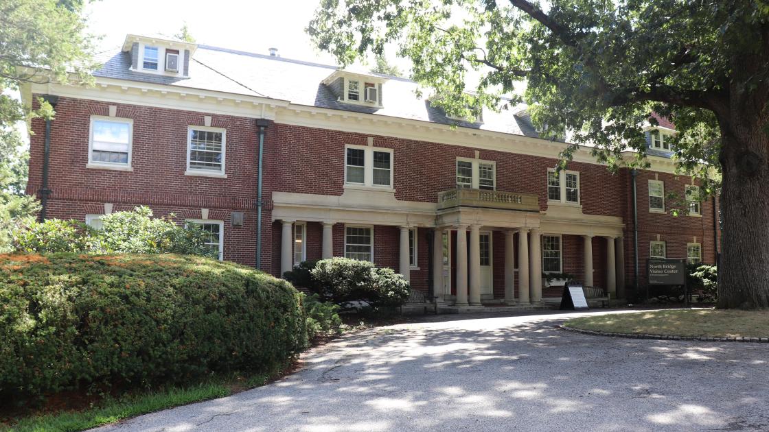
North Bridge Visitor Center
The building that today houses the North Bridge Visitor Center was originally built in 1911 by members of the Buttrick family, descendants of Major John Buttrick who commanded the colonial militia who fired on British troops at the North Bridge.
Inside the Center, visitors can find exhibits and a short film about the action at Concord on April 19, 1775. Among the objects on display is a brass cannon, which was named “The Hancock” in honor of John Hancock, one of the leaders of the Patriot movement in Massachusetts. The cannon was smuggled out of Boston in September 1774, as the colonists began to prepare for a possible confrontation with the British. Locating and retrieving this cannon and several others was one of the primary motivations for Lieutenant General Thomas Gage to order the expedition to Concord.
The Muster Field
In 1775, this was a cow pasture on the farmland of militia Captain David Brown. It was here that hundreds of militiamen from Concord and other nearby towns gathered to observe the movements of the British regulars who were searching for weapons and military supplies stockpiled by the colonists.
While the militia leaders debated what to do, smoke began to rise from Concord. The British troops were burning several wooden carriages intended for the mounting of cannons, but the militia on the Mustering Field believed that the British were burning the town itself. Several militia leaders volunteered to lead their units to the defense of Concord. Orders were given for the men to load their weapons, and then they began to march towards the North Bridge, where the “shot heard ‘round the world” would be fired.
The location of the Mustering Field was determined in part by the archeological discovery in the 1930s of two rows of discarded flints, left behind as the militiamen inserted fresh new flints into their muskets in anticipation of combat.
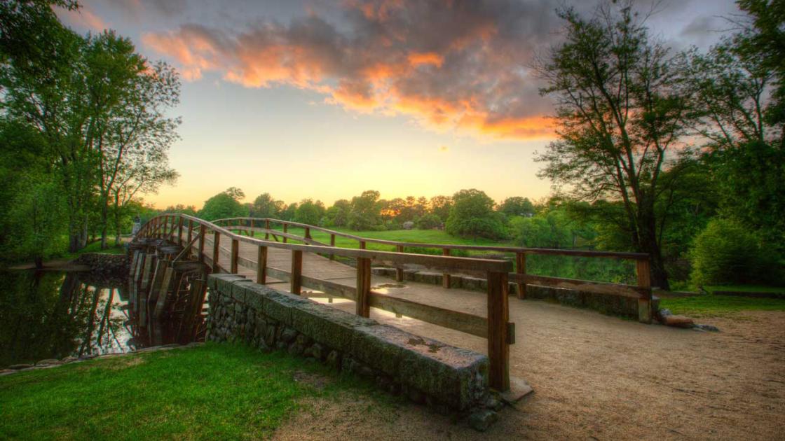
The North Bridge
The bridge that stands here today is a reconstruction of a bridge built in 1956, the fifth bridge to stand in this location. The bridge that stood here in April 1775 was torn down in 1788.
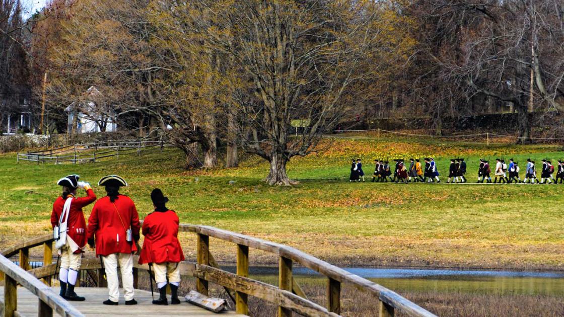
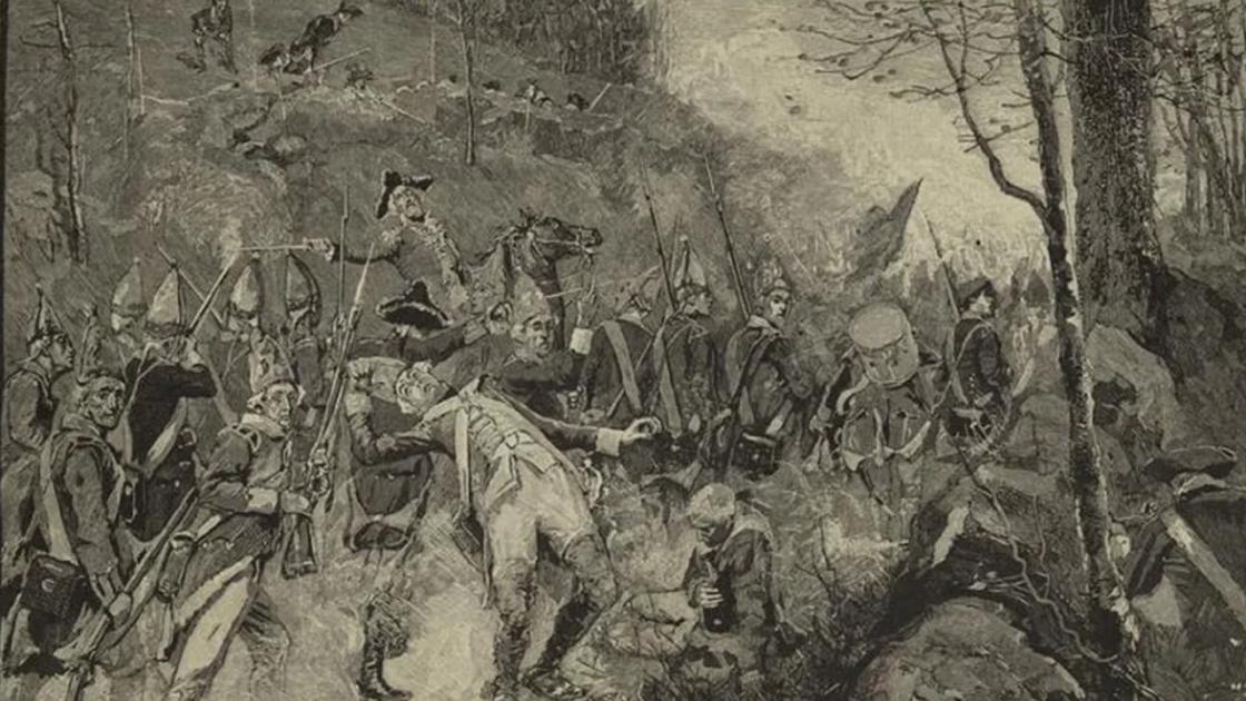
British troops under Captain Walter Laurie were assigned to guard this bridge, while another detachment of regulars went to search the farmstead of James Barrett, where they suspected a cache of weapons and military supplies had been hidden. The 115 British soldiers at the bridge watched as hundreds of militiamen from Concord and neighboring towns gathered in a nearby field.
In Concord, British troops set fire to the military supplies they had discovered. The smoke rising up convinced the militia that the British were burning the town itself, and they began to advance towards the bridge. When they were within 50 yards, some of the British troops fired their muskets without orders. In the resulting exchange of fire, two militiamen and three British soldiers were killed and several more on both sides were wounded. The “shot heard ‘round the world” had been fired.
The British fell back over the bridge into Concord. The militia pursued briefly, then returned to their original positions outside the town. As more and more militia rallied around Concord, the British prepared to march back to Boston.
Meriam's Corner
Meriam’s Corner got its name from the Meriam family, who lived in the nearby house. After deciding to withdraw from Concord and return to Boston, the column of British troops marched past this location on the afternoon of April 19, 1775.
The British column was protected by flankers, parties of soldiers moving further out on the sides of the main body to keep any would-be ambushers from getting close to the column. However, at Meriam’s Corner these flank parties had to rejoin the column in order to cross a bridge over Elm Brook. This left the British vulnerable to attack.
A company of militia from nearby Reading took advantage of the opportunity to fire on the rear of the British column. Unlike at Lexington or the North Bridge, where colonial militia leaders instructed their men not to fire until they were fired on by the British, at Meriam’s Corner the colonists opened fire on the British without waiting to be attacked. This would make the fighting here the first offensive action taken by the American colonists in the Revolutionary War.
Brooks Hill
In 1775, this piece of land along the Bay Road, running from Boston into the interior of Massachusetts, was the site of a group of homes and a tannery owned by the Brooks family, which gave Brooks Hill its name.
Responding to the news of the British march to Concord, militiamen from several nearby towns gathered on the high ground overlooking the road used by the redcoats on their return to Boston. Some of the militia, from the town of Woburn, had marched through Lexington earlier in the day and seen the bloody results of the morning action there.
Already under attack by militia forces at Meriam’s Corner, the British now engaged the colonists gathering on Brooks Hill. As the British advanced, the colonial militia fell back, continuing to fire on the redcoats from behind whatever cover was available. The fighting here delayed the British long enough to allow other militia units to prepare a deadly ambush further down the road on Elm Brook Hill.
The Bloody Angle
The British column had 16 miles to cover from Concord back to Boston. As it marched, it faced constant attack from colonial militia. These militia units were made up of men from the region, and they were able to use their familiarity with the roads and terrain to deadly effect.
After crossing over Brooks Hill, the British troops had to cross a bridge, forcing them onto a narrow and vulnerable path. Militia fired at them from natural and manmade cover like trees and stone walls. As the British soldiers turned around bends in the road, they were met with a deadly fire from their left and right. Several soldiers were killed and more wounded while navigating this section of the road.
The actions of the militia here show that this was not a chaotic, unorganized fight. Instead, militia officers carefully positioned their men for maximum effect, demonstrating a remarkable level of tactical skill and control over their units under pressure.
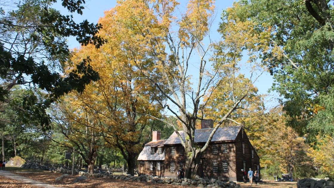
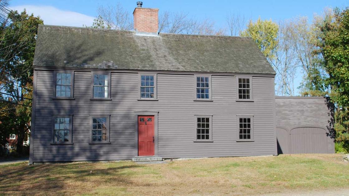
Hartwell Tavern
The Hartwell Tavern was also the home of the Hartwell family. Ephraim and Elizabeth Hartwell received thirty acres of land and the house from Ephraim’s father after the couple married. They ran a tavern out of their home for more than thirty years, beginning in 1756. By the end of the 1700s they were among the wealthiest families in the town of Lincoln.
The Hartwell Tavern was located along the Bay Road, the main road running from Boston into the interior of Massachusetts and on to New York. On April 19, 1775, a column of British soldiers marched past the tavern on their way to Concord. It was near the Hartwell Tavern that Paul Revere was captured while spreading news of the British expedition. One of Revere’s companions managed to escape and alerted the Hartwell family, who spread the word to their neighbors.
Three of Ephraim and Elizabeth’s sons took part in the fighting as members of the Lincoln minute men, while the rest of the family traveled to a more distant location for safety. When they returned, there were dead and wounded men laying along the road and on their property. The Hartwell family helped to collect five dead British soldiers who were buried in the town’s cemetery.
The building continued to serve as a private residence until 1967, when it was acquired by the National Park Service. Much of the original eighteenth century structure has been preserved.
Parker's Revenge
Around 5:30 in the morning of April 19, 1775, the first shots of the American Revolutionary War were fired on the village green of Lexington. Eight members of the town’s militia were killed by British troops, who then marched on towards Concord. After this shocking moment, Captain John Parker, leader of the Lexington militia, gathered some of the surviving members of his company and marched out to confront the British column, which was by then retreating from Concord back towards Boston.
Thanks to recent archeology, we now know exactly where this confrontation took place: a piece of rocky high ground overlooking the main road, on the border between the towns of Lexington and Lincoln. Archeological artifacts discovered here tell the story: the Lexington militia deployed on the high ground and fired on the British as they approached. When the British troops returned fire and advanced, the militia withdrew.
Captain Parker and his men departed Lexington to get their revenge against the British before noon, when the British had not yet begun their retreat from Concord. The archeological evidence shows that Parker and his men took their time to select a good position to ambush the British – more evidence of the sound tactical thinking employed by the American colonists during the battle.
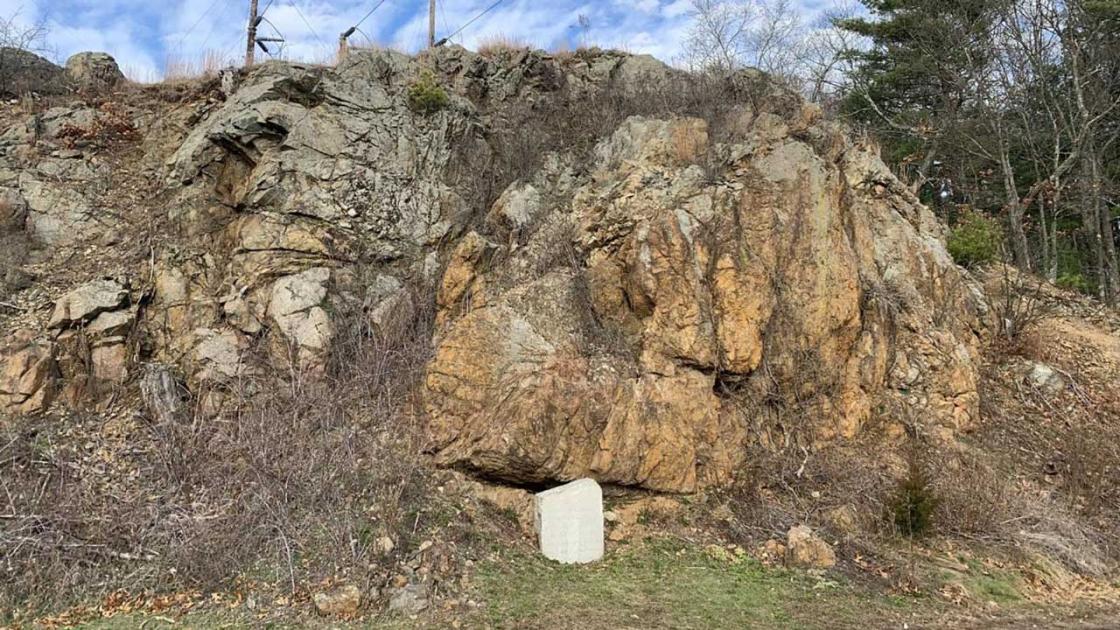
Bloody Bluff
In the 1770s, this bluff was owned by the Whittemore family. The Bay Road, the main road running from Boston into western Massachusetts, wrapped around the base of the rocky outcrop. The British column passed by this bluff on their march to Concord on the morning of April 19, 1775. Later that day, the British soldiers returned to this site as they retreated back towards Boston.
The rear guard of the British column ascended this bluff to fire on the hundreds of colonial militia who were closing in to attack. After a short exchange of fire, the outnumbered British detachment withdrew from the bluff, under constant fire from the militia. It was around this area that a British officer was shot from his horse. Colonial militia took a pair of pistols from the riderless horse, believing they belonged to Major John Pitcairn, the commander of the British marines in Boston. However, according to recent research the pistols likely belonged to Captain William Crosbie, an officer in a company of grenadiers who was listed as wounded during the day’s fighting.
The bluff’s appearance has changed significantly since the eighteenth century. Rocks were quarried from the site in the nineteenth century, and parts of the bluff were dynamited in the 1930s to create space for the widening of the road.
Fiske Hill
Members of the Fiske family settled this area beginning in 1647. In 1775, this was the site of the home of Ebenezer Fiske, who inherited the property from his father David. Ebenezer Fiske lived on his farm with his son Benjamin and his daughter in law Rebekah. There were also two at least two enslaved African Americans, Pompee and Phillis, living on the property.
When the fighting began on April 19, 1775, Ebenezer Fiske was confined to bed by illness and Benjamin Fiske was exempted from militia duty due to a leg injury. With the sounds of battle getting closer, the Fiske family fled to a neighbor’s house for shelter. British troops and colonial militia fought in and around the Fiske farmstead. When the Fiskes returned to their home later that day, they found a dead British soldier on their doorstep. Two more redcoats and an American colonist lay mortally wounded outside the house.
The eighteenth century house of the Fiske family fell into disrepair in the twentieth century, and it was demolished in 1955.